 vesseltracker.com
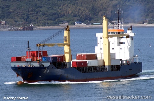
Vessel HENG YU IMO: 9158238, MMSI: 412370250 General Cargo
UTC, 34.45815, 135.13248, course: 227, speed: 12.5
UTC, 34.25244, 134.97408, course: 179, speed: 12.2
2026-03-11 14:17:47 UTC, 34.25244, 134.97408, course: 179, speed: 12.2
Live Vessel HENG YU Analytics (details, animations, etc.)
Live AIS position: UTC. Near KADA), updated 2026-03-11 14:17:47 UTC.Find the position of the vessel HENG YU on the map. The latter are known coordinates and path.
marine traffic ship tracker show on live map
The current position of vessel HENG YU is 34.25244 lat / 134.97408 lng. Updated: 2026-03-11 14:17:47 UTCCurrently sailing under the flag of China
Details:
Last coordinates of the vessel:
UTC, 34.65399, 135.26070, course: 147, speed: 11.8UTC, 34.45815, 135.13248, course: 227, speed: 12.5
UTC, 34.25244, 134.97408, course: 179, speed: 12.2
2026-03-11 14:17:47 UTC, 34.25244, 134.97408, course: 179, speed: 12.2