 vesseltracker.com
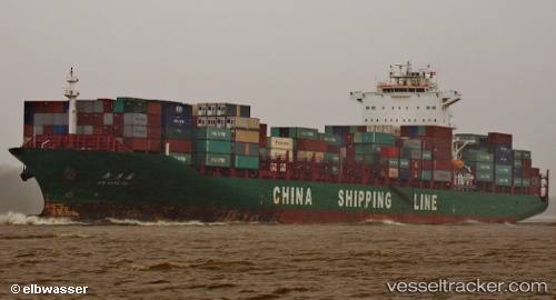
Vessel Xin Yang Pu IMO: 9320477, MMSI: 413167000 Container Ship
UTC, 12.17894, 82.53447, course: 113, speed: 14.9
UTC, 11.98919, 82.90680, course: 113, speed: 14.7
2026-01-31 09:01:01 UTC, 11.98919, 82.90680, course: 113, speed: 14.7
Live AIS position:
UTC. 166 nm E of Manapakkam),
updated 2026-01-31 09:01:01 UTC.
Find the position of the vessel Xin Yang Pu on the map. The latter are known coordinates and path.
marine traffic ship tracker show on live map
The current position of vessel Xin Yang Pu is 11.98919 lat / 82.90680 lng. Updated: 2026-01-31 09:01:01 UTCCurrently sailing under the flag of China
Xin Yang Pu built in 2008 year
Deadweight:
52200 tDetails:
Last coordinates of the vessel:
UTC, 12.17894, 82.53447, course: 113, speed: 14.9UTC, 12.17894, 82.53447, course: 113, speed: 14.9
UTC, 11.98919, 82.90680, course: 113, speed: 14.7
2026-01-31 09:01:01 UTC, 11.98919, 82.90680, course: 113, speed: 14.7