 vesseltracker.com
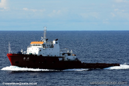
Vessel DE TIAN IMO: 9350575, MMSI: 413298790 Offshore Tug/Supply Ship
UTC, 4.47742, 99.39844, course: 306, speed: 5.8
UTC, 4.60685, 99.25606, course: -1, speed: 5.8
2026-03-02 20:01:17 UTC, 4.75500, 99.10500, course: -1, speed: 6
Live AIS position:
UTC. 64 nm NE of Belawan),
updated 2026-03-02 20:01:17 UTC.
Find the position of the vessel DE TIAN on the map. The latter are known coordinates and path.
marine traffic ship tracker show on live map
The current position of vessel DE TIAN is 4.75500 lat / 99.10500 lng. Updated: 2026-03-02 20:01:17 UTCCurrently sailing under the flag of China Peopless Republic
DE TIAN built in 2007 year
Deadweight:
3266 tDetails:
Last coordinates of the vessel:
UTC, 4.28500, 99.59833, course: -1, speed: 7UTC, 4.47742, 99.39844, course: 306, speed: 5.8
UTC, 4.60685, 99.25606, course: -1, speed: 5.8
2026-03-02 20:01:17 UTC, 4.75500, 99.10500, course: -1, speed: 6