 vesseltracker.com
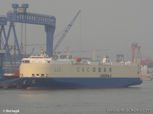
Vessel Chang Wang Long IMO: 9556789, MMSI: 413301850 Vehicles Carrier
UTC, 22.60411, 113.70889, course: 341, speed: 11.3
UTC, 22.77205, 113.63438, course: 327, speed: 11.1
2026-01-14 00:48:12 UTC, 22.86212, 113.55008, course: 313, speed: 0.3
Live AIS position:
UTC. Near Guangzhou),
updated 2026-01-14 00:48:12 UTC.
Find the position of the vessel Chang Wang Long on the map. The latter are known coordinates and path.
marine traffic ship tracker show on live map
The current position of vessel Chang Wang Long is 22.86212 lat / 113.55008 lng. Updated: 2026-01-14 00:48:12 UTCDetails:
Last coordinates of the vessel:
UTC, 22.52406, 113.73806, course: 343, speed: 14.1UTC, 22.60411, 113.70889, course: 341, speed: 11.3
UTC, 22.77205, 113.63438, course: 327, speed: 11.1
2026-01-14 00:48:12 UTC, 22.86212, 113.55008, course: 313, speed: 0.3