 vesseltracker.com
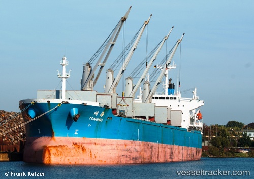
Vessel Tong Hai IMO: 9166302, MMSI: 413785000 Bulk Carrier
UTC, 31.27360, 121.56319, course: 191, speed: 5.6
UTC, 31.27360, 121.56319, course: 191, speed: 5.6
2026-01-12 22:24:15 UTC, 31.27360, 121.56319, course: 191, speed: 5.6
Live AIS position:
UTC. Near Jinqiao),
updated 2026-01-12 22:24:15 UTC.
Find the position of the vessel Tong Hai on the map. The latter are known coordinates and path.
marine traffic ship tracker show on live map
The current position of vessel Tong Hai is 31.27360 lat / 121.56319 lng. Updated: 2026-01-12 22:24:15 UTCDetails:
Last coordinates of the vessel:
UTC, 33.92890, 118.30391, course: -1, speed: 32UTC, 31.27360, 121.56319, course: 191, speed: 5.6
UTC, 31.27360, 121.56319, course: 191, speed: 5.6
2026-01-12 22:24:15 UTC, 31.27360, 121.56319, course: 191, speed: 5.6