 vesseltracker.com
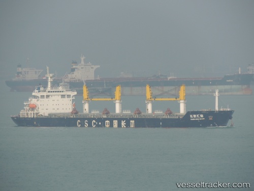
Vessel Chang Hang Hui Hai IMO: 9436109, MMSI: 414185000 Bulk Carrier
UTC, 25.41272, 56.50165, course: 237, speed: 0.1
UTC, 25.32984, 56.65051, course: 180, speed: 11.1
2026-02-17 21:28:31 UTC, 25.12339, 56.63905, course: 181, speed: 11.4
Live AIS position:
UTC. Near Offshore Fujairah),
updated 2026-02-17 21:28:31 UTC.
Find the position of the vessel Chang Hang Hui Hai on the map. The latter are known coordinates and path.
marine traffic ship tracker show on live map
The current position of vessel Chang Hang Hui Hai is 25.12339 lat / 56.63905 lng. Updated: 2026-02-17 21:28:31 UTCCurrently sailing under the flag of China
Chang Hang Hui Hai built in 2010 year
Deadweight:
57300 tDetails:
Last coordinates of the vessel:
UTC, 25.41328, 56.50173, course: 240, speed: 0.1UTC, 25.41272, 56.50165, course: 237, speed: 0.1
UTC, 25.32984, 56.65051, course: 180, speed: 11.1
2026-02-17 21:28:31 UTC, 25.12339, 56.63905, course: 181, speed: 11.4