 vesseltracker.com
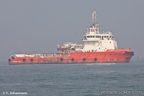
Vessel L J Johnson IMO: 9576363, MMSI: 419000208 Offshore Tug Supply Ship
UTC, 18.97331, 72.95535, course: 42, speed: 0
UTC, 18.97333, 72.95534, course: 43, speed: 0
2026-02-02 17:49:29 UTC, 18.97337, 72.95533, course: 42, speed: 0
Live AIS position:
UTC. Near NHAVA SHEVA),
updated 2026-02-02 17:49:29 UTC.
Find the position of the vessel L J Johnson on the map. The latter are known coordinates and path.
marine traffic ship tracker show on live map
The current position of vessel L J Johnson is 18.97337 lat / 72.95533 lng. Updated: 2026-02-02 17:49:29 UTCDetails:
Last coordinates of the vessel:
UTC, 18.97333, 72.95533, course: 41, speed: 0UTC, 18.97331, 72.95535, course: 42, speed: 0
UTC, 18.97333, 72.95534, course: 43, speed: 0
2026-02-02 17:49:29 UTC, 18.97337, 72.95533, course: 42, speed: 0