 vesseltracker.com
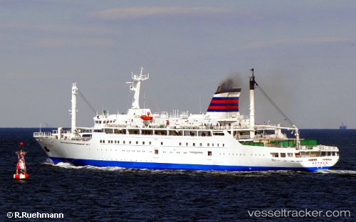
Vessel Angriya IMO: 9150353, MMSI: 419001343 Passenger General Cargo Ship
UTC, -78.01263, -54.17539, course: 324, speed: 101.7
UTC, -78.01263, -54.17539, course: 324, speed: 101.7
UTC, 18.94780, 72.84522, course: -1, speed: 0.1
UTC, 18.94780, 72.84522, course: -1, speed: 0.1
2026-02-24 05:17:18 UTC, 18.94780, 72.84522, course: -1, speed: 0.1
Live AIS position:
UTC. Near Mumbai),
updated 2026-02-24 05:17:18 UTC.
Find the position of the vessel Angriya on the map. The latter are known coordinates and path.
marine traffic ship tracker show on live map
The current position of vessel Angriya is 18.94780 lat / 72.84522 lng. Updated: 2026-02-24 05:17:18 UTCDetails:
Last coordinates of the vessel:
UTC, -78.01263, -54.17539, course: 324, speed: 101.7UTC, -78.01263, -54.17539, course: 324, speed: 101.7
UTC, -78.01263, -54.17539, course: 324, speed: 101.7
UTC, 18.94780, 72.84522, course: -1, speed: 0.1
UTC, 18.94780, 72.84522, course: -1, speed: 0.1
2026-02-24 05:17:18 UTC, 18.94780, 72.84522, course: -1, speed: 0.1