 vesseltracker.com
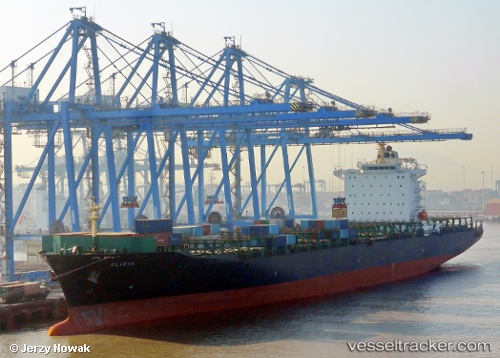
Vessel Varada IMO: 9295206, MMSI: 419001386 Container Ship
UTC, 6.94986, 79.84635, course: 190, speed: 0
UTC, 6.94983, 79.84638, course: 189, speed: 0
2026-01-15 10:25:37 UTC, 6.94984, 79.84635, course: 190, speed: 0
Live AIS position:
UTC. Near Colombo),
updated 2026-01-15 10:25:37 UTC.
Find the position of the vessel Varada on the map. The latter are known coordinates and path.
marine traffic ship tracker show on live map
The current position of vessel Varada is 6.94984 lat / 79.84635 lng. Updated: 2026-01-15 10:25:37 UTCCurrently sailing under the flag of India
Varada built in 2004 year
Deadweight:
55490 tDetails:
Last coordinates of the vessel:
UTC, 6.94984, 79.84637, course: 190, speed: 0UTC, 6.94986, 79.84635, course: 190, speed: 0
UTC, 6.94983, 79.84638, course: 189, speed: 0
2026-01-15 10:25:37 UTC, 6.94984, 79.84635, course: 190, speed: 0