 vesseltracker.com
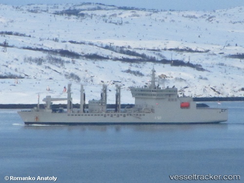
Vessel Warship 159 IMO: 9601950, MMSI: 419095100 Naval Naval Auxiliary
UTC, 18.81017, 72.57516, course: 258, speed: 15.4
UTC, 18.81017, 72.57516, course: 258, speed: 15.4
2026-01-29 01:10:22 UTC, 18.81017, 72.57516, course: 258, speed: 15.4
Live AIS position:
UTC. 14 nm SW of Air Parcel Sorting Office/Mumbai),
updated 2026-01-29 01:10:22 UTC.
Find the position of the vessel Warship 159 on the map. The latter are known coordinates and path.
marine traffic ship tracker show on live map
The current position of vessel Warship 159 is 18.81017 lat / 72.57516 lng. Updated: 2026-01-29 01:10:22 UTCDetails:
Last coordinates of the vessel:
UTC, 18.89550, 72.84917, course: 149, speed: 0.4UTC, 18.81017, 72.57516, course: 258, speed: 15.4
UTC, 18.81017, 72.57516, course: 258, speed: 15.4
2026-01-29 01:10:22 UTC, 18.81017, 72.57516, course: 258, speed: 15.4