 vesseltracker.com
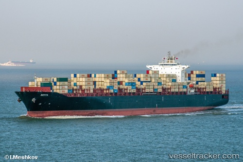
Vessel Behta IMO: 9349590, MMSI: 422031300 Container Ship
UTC, 31.11995, 122.44975, course: 290, speed: 8.4
UTC, 31.11995, 122.44975, course: 290, speed: 8.4
2026-01-31 22:29:29 UTC, 31.11995, 122.44975, course: 290, speed: 8.4
Live AIS position:
UTC. Near Jingjiang),
updated 2026-01-31 22:29:29 UTC.
Find the position of the vessel Behta on the map. The latter are known coordinates and path.
marine traffic ship tracker show on live map
The current position of vessel Behta is 31.11995 lat / 122.44975 lng. Updated: 2026-01-31 22:29:29 UTCDetails:
Last coordinates of the vessel:
UTC, 31.11581, 122.51628, course: 281, speed: 10.4UTC, 31.11995, 122.44975, course: 290, speed: 8.4
UTC, 31.11995, 122.44975, course: 290, speed: 8.4
2026-01-31 22:29:29 UTC, 31.11995, 122.44975, course: 290, speed: 8.4