 vesseltracker.com
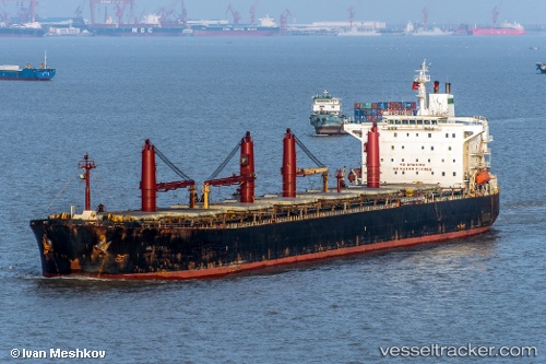
Vessel M V. Artaria IMO: 9226944, MMSI: 422040700 Bulk Carrier
UTC, 5.58559, 107.40174, course: 42, speed: 8.4
UTC, 5.77742, 107.58384, course: 43, speed: 8
2026-01-15 04:19:23 UTC, 5.97009, 107.75648, course: 41, speed: 7.6
Live AIS position:
UTC. 60 nm E of Slipi),
updated 2026-01-15 04:19:23 UTC.
Find the position of the vessel M V. Artaria on the map. The latter are known coordinates and path.
marine traffic ship tracker show on live map
The current position of vessel M V. Artaria is 5.97009 lat / 107.75648 lng. Updated: 2026-01-15 04:19:23 UTCCurrently sailing under the flag of Iran
M V. Artaria built in 2001 year
Deadweight:
72162 tDetails:
Last coordinates of the vessel:
UTC, 5.44707, 107.27209, course: 45, speed: 8.4UTC, 5.58559, 107.40174, course: 42, speed: 8.4
UTC, 5.77742, 107.58384, course: 43, speed: 8
2026-01-15 04:19:23 UTC, 5.97009, 107.75648, course: 41, speed: 7.6