.
vessel Artavil IMO: 9187629, Crude Oil Tanker
vesseltracker.com
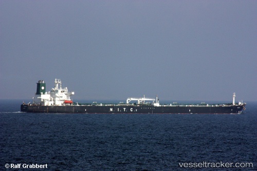
Vessel Artavil IMO: 9187629, MMSI: 422056300 Crude Oil Tanker

callsign: EPCS8
size: 47x238

Live AIS position: UTC. Near ASALUYEH), updated 2026-02-18 20:01:26 UTC.

Find the position of the vessel Artavil on the map. The latter are known coordinates and path.

marine traffic ship tracker show on live map

The current position of vessel Artavil is 27.56765 lat / 52.50243 lng. Updated: 2026-02-18 20:01:26 UTC
Details:


Last coordinates of the vessel:
UTC, 27.56765, 52.50243, course: 305, speed: 0
2026-02-18 20:01:26 UTC, 27.56765, 52.50243, course: 305, speed: 0

Track of the vessel in the last 28 days


Most frequent ports a vessels calls at Artavil (422056300):

Kharg Island, traffic: 6
Bandar Abbas, traffic: 5
Sambu, traffic: 4
Singapore, traffic: 1
PENGERANG, traffic: 1
RAJAEI, traffic: 1
PULAU SAMBU, traffic: 1

Link to the map:


Find another ship

Artavil (422056300) last ports (portcalls and passsages)

RAJAEI | 2025-06-28 07:55:38
PULAU SAMBU | 2025-01-20 08:04:26
PENGERANG | 2025-01-20 06:12:28
JINHAI HEAVY INDUSTR | 2025-01-03 08:22:26
JINHAI HEAVY INDUSTR | 2024-12-30 07:05:13
JINHAI HEAVY INDUSTR | 2024-12-26 05:28:37
JINHAI HEAVY INDUSTR | 2024-12-22 05:06:24
JINHAI HEAVY INDUSTR | 2024-12-18 04:11:37
JINHAI HEAVY INDUSTR | 2024-12-13 10:32:46
JINHAI HEAVY INDUSTR | 2024-12-09 09:48:27
Sambu | 2024-07-31 04:27:53
Kharg Island | 2024-05-16 16:05:33
Bandar Abbas | 2024-05-05 02:25:53
Kharg Island | 2024-04-24 06:21:37
Singapore | 2023-04-13 03:59:38
Bandar Abbas | 2022-12-17 11:08:12
Bandar Abbas | 2022-12-08 11:14:34
Sambu | 2022-04-08 12:45:57
Kharg Island | 2021-12-22 19:02:05
Bandar Abbas | 2021-12-07 16:19:08
Kharg Island | 2021-12-05 05:02:47