 vesseltracker.com
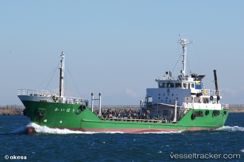
Vessel Kaihou Maru IMO: 9442079, MMSI: 431000443 Lpg Tanker
UTC, 34.03167, 131.76334, course: -1, speed: 0
UTC, 34.03167, 131.76500, course: -1, speed: 0
2026-03-24 03:35:31 UTC, 34.03167, 131.76500, course: -1, speed: 0
Live Vessel Kaihou Maru Analytics (details, animations, etc.)
Live AIS position: UTC. Near Tokuyama), updated 2026-03-24 03:35:31 UTC.Find the position of the vessel Kaihou Maru on the map. The latter are known coordinates and path.
marine traffic ship tracker show on live map
The current position of vessel Kaihou Maru is 34.03167 lat / 131.76500 lng. Updated: 2026-03-24 03:35:31 UTCCurrently sailing under the flag of Japan
Details:
Last coordinates of the vessel:
UTC, 34.03167, 131.76334, course: -1, speed: 0UTC, 34.03167, 131.76334, course: -1, speed: 0
UTC, 34.03167, 131.76500, course: -1, speed: 0
2026-03-24 03:35:31 UTC, 34.03167, 131.76500, course: -1, speed: 0