 vesseltracker.com
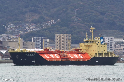
Vessel Shinju Maru No.2 IMO: 9433884, MMSI: 431000767 Lng Tanker
UTC, 34.02976, 134.63177, course: 309, speed: 0.1
UTC, 34.02976, 134.63177, course: 309, speed: 0.1
2026-03-03 13:39:09 UTC, 34.02976, 134.63177, course: 309, speed: 0.1
Live AIS position:
UTC. Near Komatsushima),
updated 2026-03-03 13:39:09 UTC.
Find the position of the vessel Shinju Maru No.2 on the map. The latter are known coordinates and path.
marine traffic ship tracker show on live map
The current position of vessel Shinju Maru No.2 is 34.02976 lat / 134.63177 lng. Updated: 2026-03-03 13:39:09 UTCCurrently sailing under the flag of Japan
Shinju Maru No.2 built in 2008 year
Deadweight:
1781 tDetails:
Last coordinates of the vessel:
UTC, 34.02976, 134.63177, course: 309, speed: 0.1UTC, 34.02976, 134.63177, course: 309, speed: 0.1
UTC, 34.02976, 134.63177, course: 309, speed: 0.1
2026-03-03 13:39:09 UTC, 34.02976, 134.63177, course: 309, speed: 0.1