 vesseltracker.com
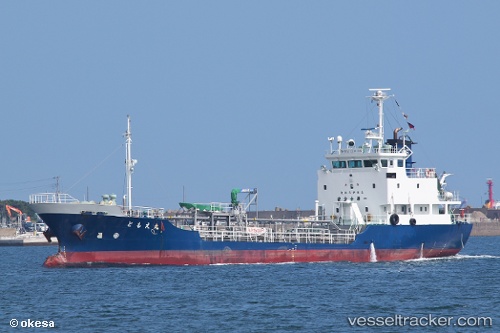
Vessel Tomoemaru IMO: 9526863, MMSI: 431000951 Chemical Tanker
UTC, 34.04667, 131.79832, course: -1, speed: 0
UTC, 34.05667, 131.79333, course: -1, speed: 0
2026-03-24 05:19:27 UTC, 34.02667, 131.77333, course: -1, speed: 10
Live Vessel Tomoemaru Analytics (details, animations, etc.)
Live AIS position: UTC. Near Tokuyama), updated 2026-03-24 05:19:27 UTC.Find the position of the vessel Tomoemaru on the map. The latter are known coordinates and path.
marine traffic ship tracker show on live map
The current position of vessel Tomoemaru is 34.02667 lat / 131.77333 lng. Updated: 2026-03-24 05:19:27 UTCDetails:
Last coordinates of the vessel:
UTC, 34.04667, 131.79832, course: -1, speed: 0UTC, 34.04667, 131.79832, course: -1, speed: 0
UTC, 34.05667, 131.79333, course: -1, speed: 0
2026-03-24 05:19:27 UTC, 34.02667, 131.77333, course: -1, speed: 10