 vesseltracker.com
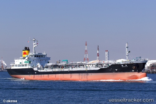
Vessel Kairyu IMO: 9552599, MMSI: 431001061 Oil Products Tanker
UTC, 34.17667, 132.28833, course: -1, speed: 0
UTC, 34.17667, 132.28833, course: -1, speed: 0
2026-03-03 21:27:41 UTC, 34.17667, 132.28833, course: -1, speed: 0
Live AIS position:
UTC. Near Iwakuni),
updated 2026-03-03 21:27:41 UTC.
Find the position of the vessel Kairyu on the map. The latter are known coordinates and path.
marine traffic ship tracker show on live map
The current position of vessel Kairyu is 34.17667 lat / 132.28833 lng. Updated: 2026-03-03 21:27:41 UTCCurrently sailing under the flag of Japan
Details:
Last coordinates of the vessel:
UTC, 34.17500, 132.28833, course: -1, speed: 0UTC, 34.17667, 132.28833, course: -1, speed: 0
UTC, 34.17667, 132.28833, course: -1, speed: 0
2026-03-03 21:27:41 UTC, 34.17667, 132.28833, course: -1, speed: 0