 vesseltracker.com
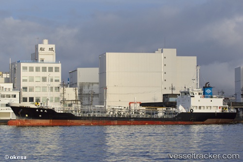
Vessel Tounan Maru IMO: 9554468, MMSI: 431001357 Chemical Tanker
UTC, 33.92727, 130.85703, course: 337, speed: 0
UTC, 33.92730, 130.85712, course: 332, speed: 0.4
2026-03-13 04:04:42 UTC, 33.85333, 131.29666, course: -1, speed: 11
Live Vessel Tounan Maru Analytics (details, animations, etc.)
Live AIS position: UTC. Near Ube), updated 2026-03-13 04:04:42 UTC.Find the position of the vessel Tounan Maru on the map. The latter are known coordinates and path.
marine traffic ship tracker show on live map
The current position of vessel Tounan Maru is 33.85333 lat / 131.29666 lng. Updated: 2026-03-13 04:04:42 UTCDetails:
Last coordinates of the vessel:
UTC, 33.92727, 130.85699, course: 336, speed: 0.1UTC, 33.92727, 130.85703, course: 337, speed: 0
UTC, 33.92730, 130.85712, course: 332, speed: 0.4
2026-03-13 04:04:42 UTC, 33.85333, 131.29666, course: -1, speed: 11