 vesseltracker.com
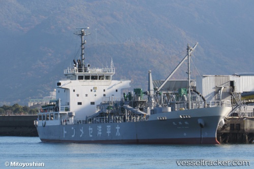
Vessel Kakuyoumaru IMO: 8649589, MMSI: 431001493 Cement Carrier
UTC, 34.35790, 132.44037, course: 9, speed: 0
UTC, 34.35790, 132.44038, course: 9, speed: 0
2026-01-28 10:08:10 UTC, 34.35789, 132.44037, course: 9, speed: 0
Live AIS position:
UTC. Near Hiroshima),
updated 2026-01-28 10:08:10 UTC.
Find the position of the vessel Kakuyoumaru on the map. The latter are known coordinates and path.
marine traffic ship tracker show on live map
The current position of vessel Kakuyoumaru is 34.35789 lat / 132.44037 lng. Updated: 2026-01-28 10:08:10 UTCDetails:
Last coordinates of the vessel:
UTC, 34.35789, 132.44037, course: 9, speed: 0UTC, 34.35790, 132.44037, course: 9, speed: 0
UTC, 34.35790, 132.44038, course: 9, speed: 0
2026-01-28 10:08:10 UTC, 34.35789, 132.44037, course: 9, speed: 0