 vesseltracker.com
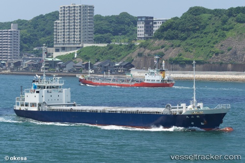
Vessel Tetsuzan Maru IMO: 9597446, MMSI: 431002141 General Cargo Ship
UTC, 34.59015, 135.45847, course: 287, speed: 0
UTC, 34.59012, 135.45857, course: 287, speed: 0
2026-01-15 18:31:52 UTC, 34.59020, 135.45856, course: 288, speed: 0
Live AIS position:
UTC. Near Toyonaka),
updated 2026-01-15 18:31:52 UTC.
Find the position of the vessel Tetsuzan Maru on the map. The latter are known coordinates and path.
marine traffic ship tracker show on live map
The current position of vessel Tetsuzan Maru is 34.59020 lat / 135.45856 lng. Updated: 2026-01-15 18:31:52 UTCDetails:
Last coordinates of the vessel:
UTC, 34.59013, 135.45850, course: 288, speed: 0UTC, 34.59015, 135.45847, course: 287, speed: 0
UTC, 34.59012, 135.45857, course: 287, speed: 0
2026-01-15 18:31:52 UTC, 34.59020, 135.45856, course: 288, speed: 0