 vesseltracker.com
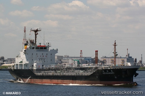
Vessel Keisen Maru IMO: 9634737, MMSI: 431003277 Oil Products Tanker
UTC, 42.58040, 141.63098, course: 318, speed: 0
UTC, 42.58082, 141.63133, course: 289, speed: 0
2026-01-30 14:30:38 UTC, 42.58136, 141.63135, course: 257, speed: 0
Live AIS position:
UTC. Near Tomakomai),
updated 2026-01-30 14:30:38 UTC.
Find the position of the vessel Keisen Maru on the map. The latter are known coordinates and path.
marine traffic ship tracker show on live map
The current position of vessel Keisen Maru is 42.58136 lat / 141.63135 lng. Updated: 2026-01-30 14:30:38 UTCCurrently sailing under the flag of Japan
Keisen Maru built in 2012 year
Deadweight:
4999 tDetails:
Last coordinates of the vessel:
UTC, 42.58025, 141.63023, course: 351, speed: 0UTC, 42.58040, 141.63098, course: 318, speed: 0
UTC, 42.58082, 141.63133, course: 289, speed: 0
2026-01-30 14:30:38 UTC, 42.58136, 141.63135, course: 257, speed: 0