 vesseltracker.com
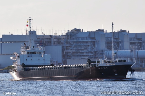
Vessel Misaki Maru IMO: 9644031, MMSI: 431003359 General Cargo Ship
UTC, 35.37667, 139.67166, course: -1, speed: 0
UTC, 35.37667, 139.67166, course: -1, speed: 0
2026-03-03 15:19:35 UTC, 35.37667, 139.67166, course: -1, speed: 0
Live AIS position:
UTC. Near Naka-Ku, Kanagawa),
updated 2026-03-03 15:19:35 UTC.
Find the position of the vessel Misaki Maru on the map. The latter are known coordinates and path.
marine traffic ship tracker show on live map
The current position of vessel Misaki Maru is 35.37667 lat / 139.67166 lng. Updated: 2026-03-03 15:19:35 UTCDetails:
Last coordinates of the vessel:
UTC, 35.37667, 139.67166, course: -1, speed: 0UTC, 35.37667, 139.67166, course: -1, speed: 0
UTC, 35.37667, 139.67166, course: -1, speed: 0
2026-03-03 15:19:35 UTC, 35.37667, 139.67166, course: -1, speed: 0