 vesseltracker.com
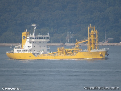
Vessel Yutakamaru No8 IMO: 9674622, MMSI: 431004346 Cement Carrier
UTC, 34.24234, 133.40805, course: 71, speed: 11.1
UTC, 34.39688, 133.90591, course: 69, speed: 13.5
2026-02-01 15:38:17 UTC, 34.39834, 134.32407, course: 74, speed: 11.3
Live AIS position:
UTC. Near SANBONMATSU),
updated 2026-02-01 15:38:17 UTC.
Find the position of the vessel Yutakamaru No8 on the map. The latter are known coordinates and path.
marine traffic ship tracker show on live map
The current position of vessel Yutakamaru No8 is 34.39834 lat / 134.32407 lng. Updated: 2026-02-01 15:38:17 UTCCurrently sailing under the flag of Japan
Details:
Last coordinates of the vessel:
UTC, 34.15478, 132.96460, course: 125, speed: 13.8UTC, 34.24234, 133.40805, course: 71, speed: 11.1
UTC, 34.39688, 133.90591, course: 69, speed: 13.5
2026-02-01 15:38:17 UTC, 34.39834, 134.32407, course: 74, speed: 11.3