 vesseltracker.com
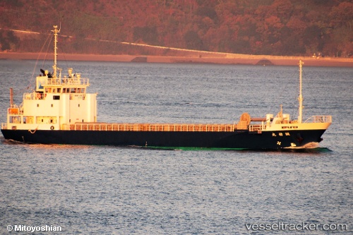
Vessel Seiyumaru IMO: 9682174, MMSI: 431004475 General Cargo Ship
UTC, 33.92702, 130.88707, course: 316, speed: 14
UTC, 33.85428, 130.40524, course: 228, speed: 11.9
2026-01-31 01:43:53 UTC, 33.68967, 130.01212, course: 246, speed: 11.3
Live AIS position:
UTC. 12 nm NW of Itoshima, Fukuoka),
updated 2026-01-31 01:43:53 UTC.
Find the position of the vessel Seiyumaru on the map. The latter are known coordinates and path.
marine traffic ship tracker show on live map
The current position of vessel Seiyumaru is 33.68967 lat / 130.01212 lng. Updated: 2026-01-31 01:43:53 UTCCurrently sailing under the flag of Japan
Details:
Last coordinates of the vessel:
UTC, 33.87218, 131.19853, course: 305, speed: 13.1UTC, 33.92702, 130.88707, course: 316, speed: 14
UTC, 33.85428, 130.40524, course: 228, speed: 11.9
2026-01-31 01:43:53 UTC, 33.68967, 130.01212, course: 246, speed: 11.3