 vesseltracker.com
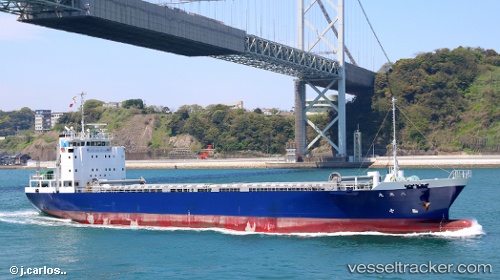
Vessel Hakkoumaru IMO: 9699787, MMSI: 431005008 General Cargo Ship
UTC, 33.89103, 131.56900, course: -1, speed: 11.4
UTC, 33.89103, 131.56900, course: -1, speed: 11.4
2026-03-03 13:44:58 UTC, 33.89103, 131.56900, course: -1, speed: 11.4
Live AIS position:
UTC. Near NAKANOSEKI),
updated 2026-03-03 13:44:58 UTC.
Find the position of the vessel Hakkoumaru on the map. The latter are known coordinates and path.
marine traffic ship tracker show on live map
The current position of vessel Hakkoumaru is 33.89103 lat / 131.56900 lng. Updated: 2026-03-03 13:44:58 UTCDetails:
Last coordinates of the vessel:
UTC, 33.89103, 131.56900, course: -1, speed: 11.4UTC, 33.89103, 131.56900, course: -1, speed: 11.4
UTC, 33.89103, 131.56900, course: -1, speed: 11.4
2026-03-03 13:44:58 UTC, 33.89103, 131.56900, course: -1, speed: 11.4