 vesseltracker.com
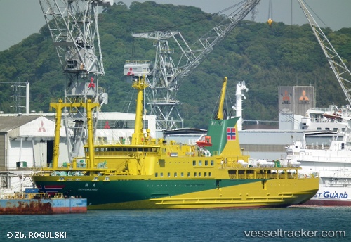
Vessel Tachibana Maru IMO: 9684158, MMSI: 431005338 Passenger General Cargo Ship
UTC, 34.47993, 139.54655, course: 3, speed: 19.3
UTC, 35.23200, 139.77946, course: -1, speed: 12.8
2026-03-01 09:26:12 UTC, 35.59116, 139.78671, course: 320, speed: 15.3
Live AIS position:
UTC. Near Aomi),
updated 2026-03-01 09:26:12 UTC.
Find the position of the vessel Tachibana Maru on the map. The latter are known coordinates and path.
marine traffic ship tracker show on live map
The current position of vessel Tachibana Maru is 35.59116 lat / 139.78671 lng. Updated: 2026-03-01 09:26:12 UTCCurrently sailing under the flag of Japan
Tachibana Maru built in 2014 year
Deadweight:
1200 tDetails:
Last coordinates of the vessel:
UTC, 34.12856, 139.48758, course: 6, speed: 16.8UTC, 34.47993, 139.54655, course: 3, speed: 19.3
UTC, 35.23200, 139.77946, course: -1, speed: 12.8
2026-03-01 09:26:12 UTC, 35.59116, 139.78671, course: 320, speed: 15.3