 vesseltracker.com
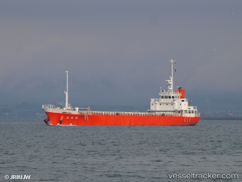
Vessel Sireimaru IMO: 9790517, MMSI: 431005884 General Cargo Ship
UTC, 34.25925, 134.63319, course: 111, speed: 11.4
UTC, 34.04158, 134.83527, course: 140, speed: 11.3
2026-01-30 09:38:01 UTC, 33.73393, 135.16940, course: 135, speed: 11.4
Live AIS position:
UTC. Near Gobo Wakayama),
updated 2026-01-30 09:38:01 UTC.
Find the position of the vessel Sireimaru on the map. The latter are known coordinates and path.
marine traffic ship tracker show on live map
The current position of vessel Sireimaru is 33.73393 lat / 135.16940 lng. Updated: 2026-01-30 09:38:01 UTCDetails:
Last coordinates of the vessel:
UTC, 34.40480, 134.20375, course: 122, speed: 11.9UTC, 34.25925, 134.63319, course: 111, speed: 11.4
UTC, 34.04158, 134.83527, course: 140, speed: 11.3
2026-01-30 09:38:01 UTC, 33.73393, 135.16940, course: 135, speed: 11.4