 vesseltracker.com
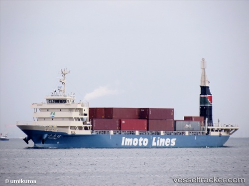
Vessel Futaba IMO: 9790593, MMSI: 431006049 Container Ship
UTC, 35.04879, 136.83121, course: 340, speed: 0
UTC, 35.04877, 136.83119, course: 340, speed: 0
2026-03-03 15:20:58 UTC, 35.04877, 136.83121, course: 340, speed: 0
Live AIS position:
UTC. Near Tobishima-Mura),
updated 2026-03-03 15:20:58 UTC.
Find the position of the vessel Futaba on the map. The latter are known coordinates and path.
marine traffic ship tracker show on live map
The current position of vessel Futaba is 35.04877 lat / 136.83121 lng. Updated: 2026-03-03 15:20:58 UTCCurrently sailing under the flag of Japan
Details:
Last coordinates of the vessel:
UTC, 35.04880, 136.83121, course: 340, speed: 0UTC, 35.04879, 136.83121, course: 340, speed: 0
UTC, 35.04877, 136.83119, course: 340, speed: 0
2026-03-03 15:20:58 UTC, 35.04877, 136.83121, course: 340, speed: 0