 vesseltracker.com
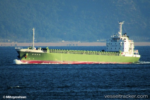
Vessel Manakamaru IMO: 9766592, MMSI: 431007681 General Cargo Ship
UTC, 33.46175, 135.89603, course: 226, speed: 13.4
UTC, 33.49884, 135.53699, course: 291, speed: 11.7
2026-01-28 21:24:56 UTC, 33.64705, 135.27209, course: 316, speed: 11.5
Live AIS position:
UTC. 15 nm SE of Gobo Wakayama),
updated 2026-01-28 21:24:56 UTC.
Find the position of the vessel Manakamaru on the map. The latter are known coordinates and path.
marine traffic ship tracker show on live map
The current position of vessel Manakamaru is 33.64705 lat / 135.27209 lng. Updated: 2026-01-28 21:24:56 UTCCurrently sailing under the flag of Japan
Details:
Last coordinates of the vessel:
UTC, 33.74385, 136.27698, course: 229, speed: 13.5UTC, 33.46175, 135.89603, course: 226, speed: 13.4
UTC, 33.49884, 135.53699, course: 291, speed: 11.7
2026-01-28 21:24:56 UTC, 33.64705, 135.27209, course: 316, speed: 11.5