 vesseltracker.com
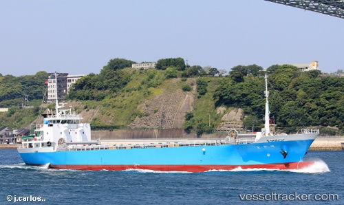
Vessel Hayato IMO: 9805738, MMSI: 431007856 General Cargo Ship
UTC, 35.04561, 136.88535, course: 91, speed: 0.1
UTC, 35.04561, 136.88536, course: 92, speed: 0
2026-01-29 11:30:01 UTC, 35.04562, 136.88538, course: 92, speed: 0
Live AIS position:
UTC. Near Nagoya),
updated 2026-01-29 11:30:01 UTC.
Find the position of the vessel Hayato on the map. The latter are known coordinates and path.
marine traffic ship tracker show on live map
The current position of vessel Hayato is 35.04562 lat / 136.88538 lng. Updated: 2026-01-29 11:30:01 UTCCurrently sailing under the flag of Japan
Details:
Last coordinates of the vessel:
UTC, 35.04518, 136.88567, course: 91, speed: 0UTC, 35.04561, 136.88535, course: 91, speed: 0.1
UTC, 35.04561, 136.88536, course: 92, speed: 0
2026-01-29 11:30:01 UTC, 35.04562, 136.88538, course: 92, speed: 0