 vesseltracker.com
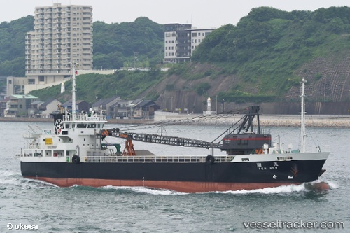
Vessel Tensho IMO: 9810018, MMSI: 431009101 General Cargo Ship
UTC, 33.96417, 133.22957, course: 218, speed: 0
UTC, 33.96393, 133.22968, course: 253, speed: 0.1
2026-03-24 23:34:47 UTC, 33.96338, 133.22868, course: 40, speed: 0.2
Live Vessel Tensho Analytics (details, animations, etc.)
Live AIS position: UTC. Near NYUGAWA), updated 2026-03-24 23:34:47 UTC.Find the position of the vessel Tensho on the map. The latter are known coordinates and path.
marine traffic ship tracker show on live map
The current position of vessel Tensho is 33.96338 lat / 133.22868 lng. Updated: 2026-03-24 23:34:47 UTCCurrently sailing under the flag of Japan
Details:
Last coordinates of the vessel:
UTC, 33.96395, 133.22968, course: 241, speed: 0UTC, 33.96417, 133.22957, course: 218, speed: 0
UTC, 33.96393, 133.22968, course: 253, speed: 0.1
2026-03-24 23:34:47 UTC, 33.96338, 133.22868, course: 40, speed: 0.2