 vesseltracker.com
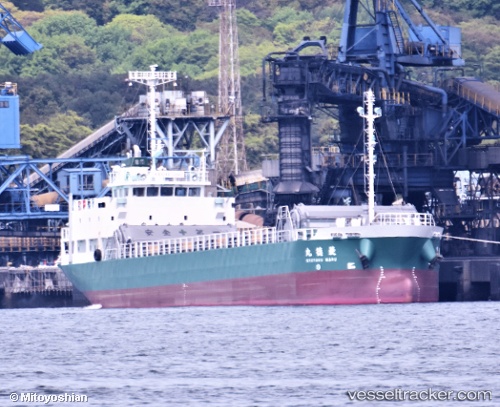
Vessel Ryotoku Maru IMO: 9805049, MMSI: 431009321 General Cargo Ship
UTC, 34.47693, 133.68022, course: 225, speed: 10.5
UTC, 34.08131, 133.34357, course: 224, speed: 10.4
2026-03-19 11:35:04 UTC, 33.99661, 133.26308, course: 210, speed: 0
Live Vessel Ryotoku Maru Analytics (details, animations, etc.)
Live AIS position: UTC. Near NYUGAWA), updated 2026-03-19 11:35:04 UTC.Find the position of the vessel Ryotoku Maru on the map. The latter are known coordinates and path.
marine traffic ship tracker show on live map
The current position of vessel Ryotoku Maru is 33.99661 lat / 133.26308 lng. Updated: 2026-03-19 11:35:04 UTCDetails:
Last coordinates of the vessel:
UTC, 34.49699, 133.76102, course: 6, speed: 0UTC, 34.47693, 133.68022, course: 225, speed: 10.5
UTC, 34.08131, 133.34357, course: 224, speed: 10.4
2026-03-19 11:35:04 UTC, 33.99661, 133.26308, course: 210, speed: 0