 vesseltracker.com
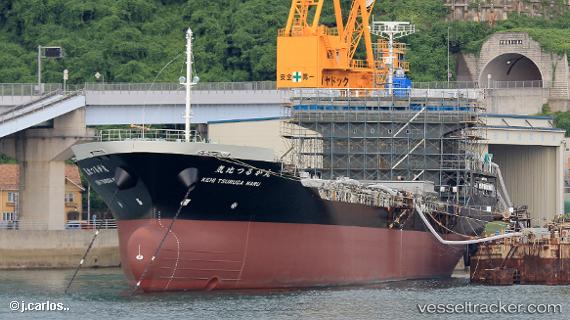
Vessel Kehi Tsuruga Maru IMO: 9815472, MMSI: 431010345 General Cargo Ship
UTC, 35.77392, 134.75087, course: 249, speed: 9.4
UTC, 35.65503, 134.31660, course: 257, speed: 8.4
2026-02-01 09:40:48 UTC, 35.60943, 134.09737, course: 273, speed: 8.8
Live AIS position:
UTC. Near Tsuyama, Okayama),
updated 2026-02-01 09:40:48 UTC.
Find the position of the vessel Kehi Tsuruga Maru on the map. The latter are known coordinates and path.
marine traffic ship tracker show on live map
The current position of vessel Kehi Tsuruga Maru is 35.60943 lat / 134.09737 lng. Updated: 2026-02-01 09:40:48 UTCDetails:
Last coordinates of the vessel:
UTC, 35.80392, 135.15836, course: 269, speed: 9.2UTC, 35.77392, 134.75087, course: 249, speed: 9.4
UTC, 35.65503, 134.31660, course: 257, speed: 8.4
2026-02-01 09:40:48 UTC, 35.60943, 134.09737, course: 273, speed: 8.8