 vesseltracker.com
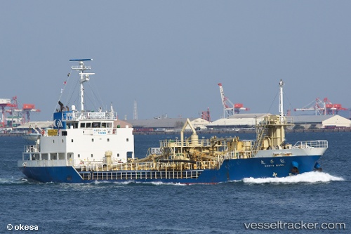
Vessel Shoyo Maru IMO: 9370898, MMSI: 431101122 Cement Carrier
UTC, 34.75500, 134.65833, course: -1, speed: 0
UTC, 34.75634, 134.65987, course: 323, speed: 0
2026-03-15 17:39:54 UTC, 34.75644, 134.65897, course: 41, speed: 0
Live Vessel Shoyo Maru Analytics (details, animations, etc.)
Live AIS position: UTC. Near HIMEJI), updated 2026-03-15 17:39:54 UTC.Find the position of the vessel Shoyo Maru on the map. The latter are known coordinates and path.
marine traffic ship tracker show on live map
The current position of vessel Shoyo Maru is 34.75644 lat / 134.65897 lng. Updated: 2026-03-15 17:39:54 UTCCurrently sailing under the flag of Japan
Details:
Last coordinates of the vessel:
UTC, 34.75629, 134.65929, course: 7, speed: 0.1UTC, 34.75500, 134.65833, course: -1, speed: 0
UTC, 34.75634, 134.65987, course: 323, speed: 0
2026-03-15 17:39:54 UTC, 34.75644, 134.65897, course: 41, speed: 0