 vesseltracker.com
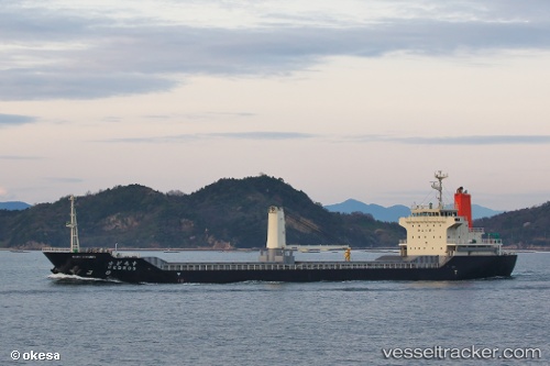
Vessel Cedros IMO: 9386263, MMSI: 431101136 General Cargo Ship
UTC, 34.19865, 134.67627, course: 320, speed: 9.4
UTC, 34.32791, 134.45218, course: 294, speed: 11.2
2026-01-29 11:31:30 UTC, 34.42751, 134.01234, course: 248, speed: 10.8
Live AIS position:
UTC. Near Matsuga-hana),
updated 2026-01-29 11:31:30 UTC.
Find the position of the vessel Cedros on the map. The latter are known coordinates and path.
marine traffic ship tracker show on live map
The current position of vessel Cedros is 34.42751 lat / 134.01234 lng. Updated: 2026-01-29 11:31:30 UTCDetails:
Last coordinates of the vessel:
UTC, 34.20586, 135.14236, course: 162, speed: 0UTC, 34.19865, 134.67627, course: 320, speed: 9.4
UTC, 34.32791, 134.45218, course: 294, speed: 11.2
2026-01-29 11:31:30 UTC, 34.42751, 134.01234, course: 248, speed: 10.8