 vesseltracker.com
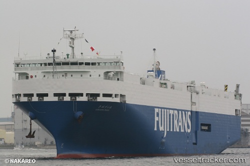
Vessel Kinuura Maru IMO: 9372339, MMSI: 431101175 Vehicles Carrier
UTC, 35.05772, 136.87830, course: 18, speed: 0
UTC, 35.05777, 136.87831, course: 18, speed: 0
2026-02-01 03:22:32 UTC, 35.05776, 136.87831, course: 18, speed: 0
Live AIS position:
UTC. Near Nagoya),
updated 2026-02-01 03:22:32 UTC.
Find the position of the vessel Kinuura Maru on the map. The latter are known coordinates and path.
marine traffic ship tracker show on live map
The current position of vessel Kinuura Maru is 35.05776 lat / 136.87831 lng. Updated: 2026-02-01 03:22:32 UTCCurrently sailing under the flag of Japan
Kinuura Maru built in 2007 year
Deadweight:
5820 tDetails:
Last coordinates of the vessel:
UTC, 35.05774, 136.87831, course: 18, speed: 0UTC, 35.05772, 136.87830, course: 18, speed: 0
UTC, 35.05777, 136.87831, course: 18, speed: 0
2026-02-01 03:22:32 UTC, 35.05776, 136.87831, course: 18, speed: 0