 vesseltracker.com
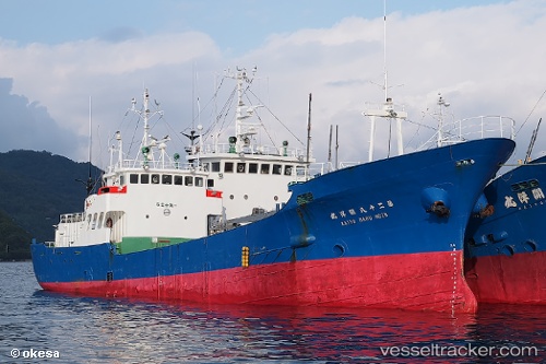
Vessel Kaiyo Maru No.28 IMO: 7313250, MMSI: 431231000 Fishing Vessel
UTC, 32.75893, 129.46211, course: 279, speed: 9.6
UTC, 32.84143, 129.01369, course: 214, speed: 0.9
2026-02-01 03:14:18 UTC, 32.85573, 129.01457, course: 80, speed: 0
Live AIS position:
UTC. 24 nm NW of Ulju-gun/Ulsan),
updated 2026-02-01 03:14:18 UTC.
Find the position of the vessel Kaiyo Maru No.28 on the map. The latter are known coordinates and path.
marine traffic ship tracker show on live map
The current position of vessel Kaiyo Maru No.28 is 32.85573 lat / 129.01457 lng. Updated: 2026-02-01 03:14:18 UTCDetails:
Last coordinates of the vessel:
UTC, 32.71247, 129.81236, course: 274, speed: 10.1UTC, 32.75893, 129.46211, course: 279, speed: 9.6
UTC, 32.84143, 129.01369, course: 214, speed: 0.9
2026-02-01 03:14:18 UTC, 32.85573, 129.01457, course: 80, speed: 0