 vesseltracker.com
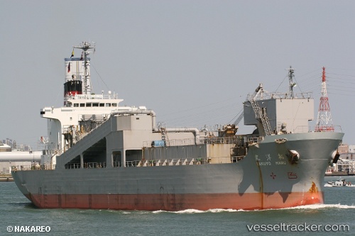
Vessel Takuyo Maru IMO: 9176498, MMSI: 431300759 Limestone Carrier
UTC, 34.17846, 137.12302, course: 236, speed: 13.2
UTC, 33.98350, 136.80754, course: 235, speed: 12.6
2026-01-29 00:27:14 UTC, 33.59481, 136.19490, course: 235, speed: 13.5
Live AIS position:
UTC. 27 nm SE of Minachi),
updated 2026-01-29 00:27:14 UTC.
Find the position of the vessel Takuyo Maru on the map. The latter are known coordinates and path.
marine traffic ship tracker show on live map
The current position of vessel Takuyo Maru is 33.59481 lat / 136.19490 lng. Updated: 2026-01-29 00:27:14 UTCCurrently sailing under the flag of Japan
Takuyo Maru built in 1998 year
Deadweight:
10750 tDetails:
Last coordinates of the vessel:
UTC, 34.32766, 137.53651, course: 257, speed: 12.6UTC, 34.17846, 137.12302, course: 236, speed: 13.2
UTC, 33.98350, 136.80754, course: 235, speed: 12.6
2026-01-29 00:27:14 UTC, 33.59481, 136.19490, course: 235, speed: 13.5