 vesseltracker.com
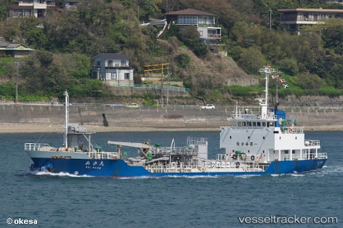
Vessel Aki Maru IMO: 9249740, MMSI: 431301565 Cement Carrier
UTC, 32.15076, 130.06139, course: 33, speed: 11.6
UTC, 32.35068, 130.41969, course: 49, speed: 8
2026-02-12 19:25:28 UTC, 32.35068, 130.41969, course: 49, speed: 8
Live AIS position:
UTC. Near MINAMATA),
updated 2026-02-12 19:25:28 UTC.
Find the position of the vessel Aki Maru on the map. The latter are known coordinates and path.
marine traffic ship tracker show on live map
The current position of vessel Aki Maru is 32.35068 lat / 130.41969 lng. Updated: 2026-02-12 19:25:28 UTCCurrently sailing under the flag of Japan
Aki Maru built in 2001 year
Deadweight:
1745 tDetails:
Last coordinates of the vessel:
UTC, 32.15076, 130.06139, course: 33, speed: 11.6UTC, 32.15076, 130.06139, course: 33, speed: 11.6
UTC, 32.35068, 130.41969, course: 49, speed: 8
2026-02-12 19:25:28 UTC, 32.35068, 130.41969, course: 49, speed: 8