 vesseltracker.com
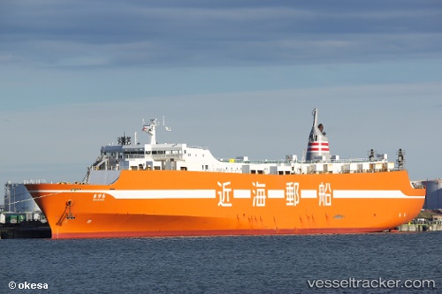
Vessel Nanotsu IMO: 9219513, MMSI: 431401807 Ro Ro Cargo Ship
UTC, 34.16363, 130.60471, course: 35, speed: 19.3
UTC, 34.41917, 130.84402, course: -1, speed: 18.6
2026-03-14 15:13:43 UTC, 34.41917, 130.84402, course: -1, speed: 18.6
Live Vessel Nanotsu Analytics (details, animations, etc.)
Live AIS position: UTC. 18 nm W of SENZAKI), updated 2026-03-14 15:13:43 UTC.Find the position of the vessel Nanotsu on the map. The latter are known coordinates and path.
marine traffic ship tracker show on live map
The current position of vessel Nanotsu is 34.41917 lat / 130.84402 lng. Updated: 2026-03-14 15:13:43 UTCDetails:
Last coordinates of the vessel:
UTC, 33.64818, 130.30830, course: 294, speed: 14.7UTC, 34.16363, 130.60471, course: 35, speed: 19.3
UTC, 34.41917, 130.84402, course: -1, speed: 18.6
2026-03-14 15:13:43 UTC, 34.41917, 130.84402, course: -1, speed: 18.6