 vesseltracker.com
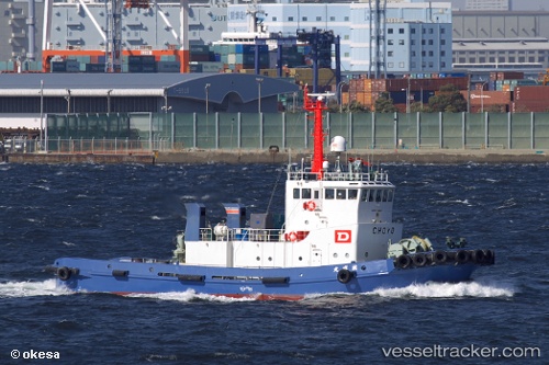
Vessel Choyo Maru IMO: 9119842, MMSI: 431706000 Tug
UTC, 32.72619, 129.85498, course: 40, speed: 11.2
UTC, 32.72619, 129.85498, course: 40, speed: 11.2
2026-02-24 13:00:57 UTC, 32.72619, 129.85498, course: 40, speed: 11.2
Live AIS position:
UTC. Near Nagasaki),
updated 2026-02-24 13:00:57 UTC.
Find the position of the vessel Choyo Maru on the map. The latter are known coordinates and path.
marine traffic ship tracker show on live map
The current position of vessel Choyo Maru is 32.72619 lat / 129.85498 lng. Updated: 2026-02-24 13:00:57 UTCDetails:
Last coordinates of the vessel:
UTC, 32.71011, 129.81895, course: 266, speed: 5.2UTC, 32.72619, 129.85498, course: 40, speed: 11.2
UTC, 32.72619, 129.85498, course: 40, speed: 11.2
2026-02-24 13:00:57 UTC, 32.72619, 129.85498, course: 40, speed: 11.2