 vesseltracker.com
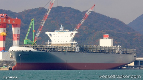
Vessel Madrid Bridge IMO: 9805453, MMSI: 431981000 Container Ship
UTC, 22.68148, 113.66195, course: 240, speed: 0.1
UTC, 22.68152, 113.66195, course: 240, speed: 0.1
2026-02-25 09:46:38 UTC, 22.68154, 113.66200, course: 240, speed: 0.1
Live AIS position:
UTC. Near Nansha),
updated 2026-02-25 09:46:38 UTC.
Find the position of the vessel Madrid Bridge on the map. The latter are known coordinates and path.
marine traffic ship tracker show on live map
The current position of vessel Madrid Bridge is 22.68154 lat / 113.66200 lng. Updated: 2026-02-25 09:46:38 UTCCurrently sailing under the flag of Japan
Details:
Last coordinates of the vessel:
UTC, 22.68147, 113.66193, course: 240, speed: 0.2UTC, 22.68148, 113.66195, course: 240, speed: 0.1
UTC, 22.68152, 113.66195, course: 240, speed: 0.1
2026-02-25 09:46:38 UTC, 22.68154, 113.66200, course: 240, speed: 0.1