 vesseltracker.com
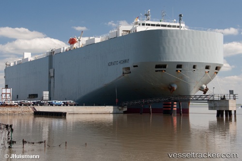
Find the position of the vessel Adriatic Highway on the map. The latter are known coordinates and path.
marine traffic ship tracker show on live map
The current position of vessel Adriatic Highway is 10.8495 lat / -82.2056 lng. Updated: 2024-05-02 18:40:35 UTCPort of registry:
Kobe (capital city of Hyogo Prefecture, Japan)Gross tonnage:
58990Service entry:
2008-01-01T00:00:00ZManufacturer:
Imabari Shipbuilding Marugame Headquarters (Shipyard in Japan)
Details:
Last coordinates of the vessel:
UTC, 10.2035, -82.6991, course: 35, speed: 17.4UTC, 10.5186, -82.4676, course: 35, speed: 17
UTC, 10.8075, -82.2344, course: 33, speed: 16.6
2024-05-02 18:40:35 UTC, 10.8495, -82.2056, course: 32, speed: 16.6