 vesseltracker.com
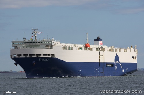
Vessel Toyofujimaru No.2 IMO: 9412579, MMSI: 432667000 Vehicles Carrier
UTC, 33.88079, 130.99257, course: 204, speed: 3.9
UTC, 33.77139, 131.66080, course: 102, speed: 20.7
2026-01-31 12:08:33 UTC, 33.07328, 132.18423, course: 140, speed: 22
Live AIS position:
UTC. 15 nm E of SAEKI),
updated 2026-01-31 12:08:33 UTC.
Find the position of the vessel Toyofujimaru No.2 on the map. The latter are known coordinates and path.
marine traffic ship tracker show on live map
The current position of vessel Toyofujimaru No.2 is 33.07328 lat / 132.18423 lng. Updated: 2026-01-31 12:08:33 UTCCurrently sailing under the flag of Japan
Toyofujimaru No.2 built in 2008 year
Deadweight:
6090 tDetails:
Last coordinates of the vessel:
UTC, 33.88184, 130.99420, course: 193, speed: 0UTC, 33.88079, 130.99257, course: 204, speed: 3.9
UTC, 33.77139, 131.66080, course: 102, speed: 20.7
2026-01-31 12:08:33 UTC, 33.07328, 132.18423, course: 140, speed: 22