 vesseltracker.com
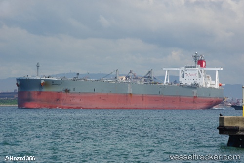
Vessel Sakuragawa IMO: 9391751, MMSI: 432707000 Crude Oil Tanker
UTC, 30.83188, 134.71620, course: 232, speed: 16.1
UTC, 30.47058, 134.19987, course: 232, speed: 16.2
2026-01-29 05:05:07 UTC, 30.28227, 133.93633, course: 232, speed: 16.5
Live AIS position:
UTC. 152 nm SE of ABURATSU),
updated 2026-01-29 05:05:07 UTC.
Find the position of the vessel Sakuragawa on the map. The latter are known coordinates and path.
marine traffic ship tracker show on live map
The current position of vessel Sakuragawa is 30.28227 lat / 133.93633 lng. Updated: 2026-01-29 05:05:07 UTCCurrently sailing under the flag of Japan
Details:
Last coordinates of the vessel:
UTC, 31.09226, 135.07671, course: 231, speed: 15.5UTC, 30.83188, 134.71620, course: 232, speed: 16.1
UTC, 30.47058, 134.19987, course: 232, speed: 16.2
2026-01-29 05:05:07 UTC, 30.28227, 133.93633, course: 232, speed: 16.5