 vesseltracker.com
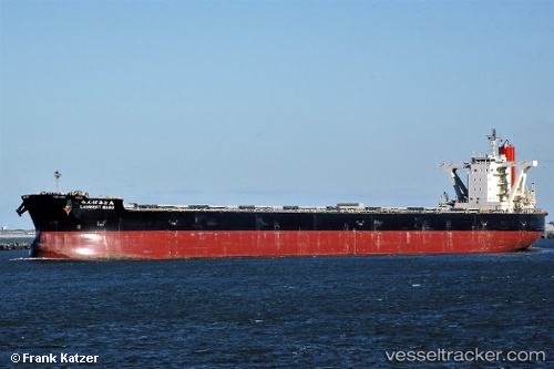
Vessel Lambert Maru IMO: 9558206, MMSI: 432870000 Bulk Carrier
UTC, 36.75792, 36.11894, course: 322, speed: 0.1
UTC, 36.76102, 36.11422, course: 114, speed: 0.1
2026-01-28 01:47:51 UTC, 36.76113, 36.11474, course: 120, speed: 0.1
Live AIS position:
UTC. Near Isdemir),
updated 2026-01-28 01:47:51 UTC.
Find the position of the vessel Lambert Maru on the map. The latter are known coordinates and path.
marine traffic ship tracker show on live map
The current position of vessel Lambert Maru is 36.76113 lat / 36.11474 lng. Updated: 2026-01-28 01:47:51 UTCDetails:
Last coordinates of the vessel:
UTC, 36.75810, 36.12009, course: 301, speed: 0UTC, 36.75792, 36.11894, course: 322, speed: 0.1
UTC, 36.76102, 36.11422, course: 114, speed: 0.1
2026-01-28 01:47:51 UTC, 36.76113, 36.11474, course: 120, speed: 0.1