 vesseltracker.com
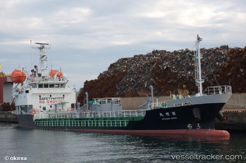
Vessel Ryoumeimaru IMO: 9682083, MMSI: 432941000 Bitumen Tanker
UTC, 33.62263, 130.40489, course: 281, speed: 0
UTC, 33.76367, 130.33591, course: 38, speed: 12
2026-02-01 09:39:40 UTC, 33.94646, 130.59743, course: 71, speed: 12.6
Live AIS position:
UTC. Near Hibiki-Nada),
updated 2026-02-01 09:39:40 UTC.
Find the position of the vessel Ryoumeimaru on the map. The latter are known coordinates and path.
marine traffic ship tracker show on live map
The current position of vessel Ryoumeimaru is 33.94646 lat / 130.59743 lng. Updated: 2026-02-01 09:39:40 UTCCurrently sailing under the flag of Japan
Details:
Last coordinates of the vessel:
UTC, 33.62263, 130.40489, course: 281, speed: 0UTC, 33.62263, 130.40489, course: 281, speed: 0
UTC, 33.76367, 130.33591, course: 38, speed: 12
2026-02-01 09:39:40 UTC, 33.94646, 130.59743, course: 71, speed: 12.6