 vesseltracker.com
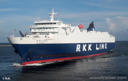
Vessel Miyarabi2 IMO: 9580338, MMSI: 432995000 Ro Ro Cargo Ship
UTC, 32.33708, 129.78587, course: 153, speed: 19.2
UTC, 32.33708, 129.78587, course: 153, speed: 19.2
2026-01-14 18:10:27 UTC, 31.39738, 130.07367, course: 155, speed: 19.6
Live AIS position:
UTC. 14 nm NW of Taniyama),
updated 2026-01-14 18:10:27 UTC.
Find the position of the vessel Miyarabi2 on the map. The latter are known coordinates and path.
marine traffic ship tracker show on live map
The current position of vessel Miyarabi2 is 31.39738 lat / 130.07367 lng. Updated: 2026-01-14 18:10:27 UTCCurrently sailing under the flag of Japan
Details:
Last coordinates of the vessel:
UTC, 32.73905, 129.56090, course: 154, speed: 19.1UTC, 32.33708, 129.78587, course: 153, speed: 19.2
UTC, 32.33708, 129.78587, course: 153, speed: 19.2
2026-01-14 18:10:27 UTC, 31.39738, 130.07367, course: 155, speed: 19.6