 vesseltracker.com
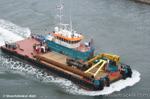
Vessel Coastal Discovery IMO: 9563861, MMSI: 436000253 Work Repair Vessel
UTC, 25.47097, 55.51063, course: 204, speed: 0
UTC, 25.47093, 55.51060, course: 208, speed: 0.1
2026-01-16 09:47:09 UTC, 25.47093, 55.51060, course: 208, speed: 0.1
Live AIS position:
UTC. Near Al Hamriyah),
updated 2026-01-16 09:47:09 UTC.
Find the position of the vessel Coastal Discovery on the map. The latter are known coordinates and path.
marine traffic ship tracker show on live map
The current position of vessel Coastal Discovery is 25.47093 lat / 55.51060 lng. Updated: 2026-01-16 09:47:09 UTCDetails:
Last coordinates of the vessel:
UTC, 25.47092, 55.51060, course: 205, speed: 0.1UTC, 25.47097, 55.51063, course: 204, speed: 0
UTC, 25.47093, 55.51060, course: 208, speed: 0.1
2026-01-16 09:47:09 UTC, 25.47093, 55.51060, course: 208, speed: 0.1