 vesseltracker.com
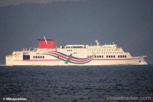
Vessel New Star IMO: 9202833, MMSI: 440075110 Passenger Ro Ro Cargo Ship
UTC, 34.60720, 127.65534, course: -1, speed: 16.2
UTC, 34.60720, 127.65534, course: -1, speed: 16.2
2026-03-04 18:46:40 UTC, 34.60720, 127.65534, course: -1, speed: 16.2
Live Vessel New Star Analytics (details, animations, etc.)
Live AIS position: UTC. Near Yeosu), updated 2026-03-04 18:46:40 UTC.Find the position of the vessel New Star on the map. The latter are known coordinates and path.
marine traffic ship tracker show on live map
The current position of vessel New Star is 34.60720 lat / 127.65534 lng. Updated: 2026-03-04 18:46:40 UTCDetails:
Last coordinates of the vessel:
UTC, 34.72539, 127.71510, course: -1, speed: 0UTC, 34.60720, 127.65534, course: -1, speed: 16.2
UTC, 34.60720, 127.65534, course: -1, speed: 16.2
2026-03-04 18:46:40 UTC, 34.60720, 127.65534, course: -1, speed: 16.2